CB Loop Tour, Vietnam #6
October 13, Tour Day 2
Awake by 0530, but we were in bed by 2030 last night, as we were exhausted. Finally got out of bed by 0630. We put on sun tan lotion and mostly packed – not much to do. At 0730, we went out and strolled by the river and around the homestay area again. So serene and peaceful. 0800 Em found us and we were served breakfast. We had a pancake – of sorts, each having a small bowl of local honey, a fried egg, and papaya. No drinks – coffee or tea were offered. But it was yummy!
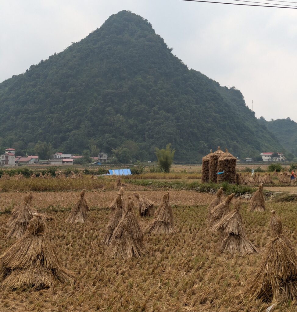
0830 we were on our way. We passed through small villages with the townspeople doing, well every day things – washing dishes; working their tiny fields; setting out rice to dry- from the harvest of rice just obtained; moving their cattle – up the road – to get to feeding areas. We even saw a cow being “dressed(?)”, maybe “cleaned” after it had just been slaughtered, right on the edge of the road.
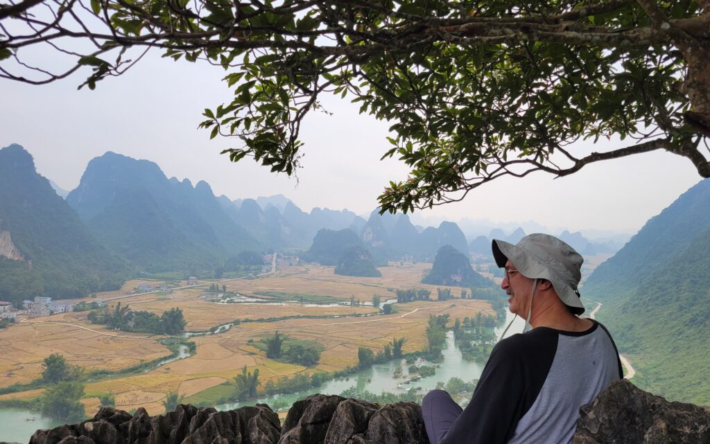
At 0900, we stopped and Em took us on a hike up a scenic overlook. Goggle calls it a Panoramic View Trail. I stopped at the first overlook area, it was a bit too much for my knees. Jeff and Em went on up. It’s a great spot – looking out to the valley below, and at the fields just harvested with horses grazing. This whole area is so scenic – seeing and hearing the nearby river is so peaceful. I could hear kids playing, and roosters crowing. There are a bunch of butterflies flittering all about, anywhere we go around here. Also I did not mention yesterday, the waterfalls and some of this area is a part of UNESCO Global Geopark. Which means it “is an exceptional territory in which it’s possible to explore the history of our Planet Earth for over 500 million years through protected sites,” as per Cao Bang Geopark website. Jeff and Em came back down and we all got back on the bikes by 0930.
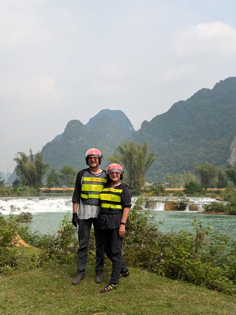
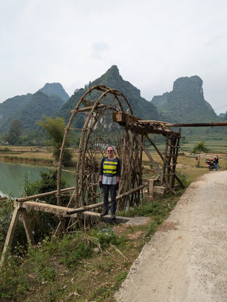
We didn’t get very far until we stopped again at a little rapid area where a man was fishing. It was a photo op place for Em to take our picture(s! She has to be an instagrammer. Hee-Hee) Then we got going again to stop again this time at a water wheel 🛞 on the river. We saw some yesterday, but they weren’t operational – this one is. The wheels carry water from the river up into sluices/troughs. Then the water goes into irrigation canals, and finally to the terraced plots, albeit rice paddies or corn fields. That was neat to see. We now load up and move on.
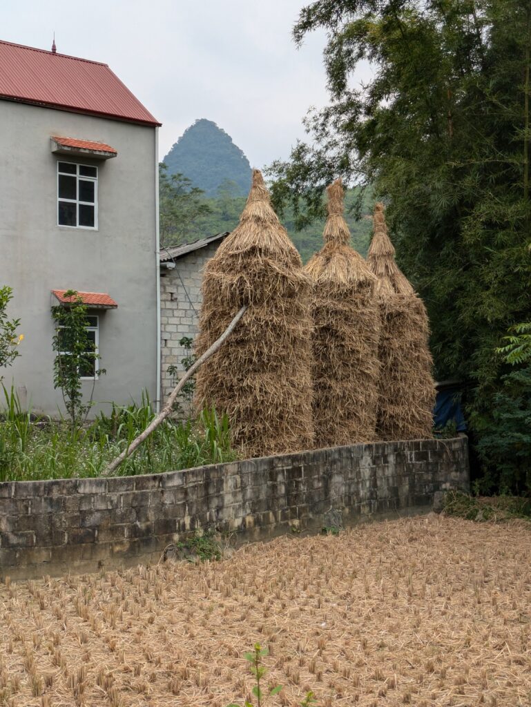
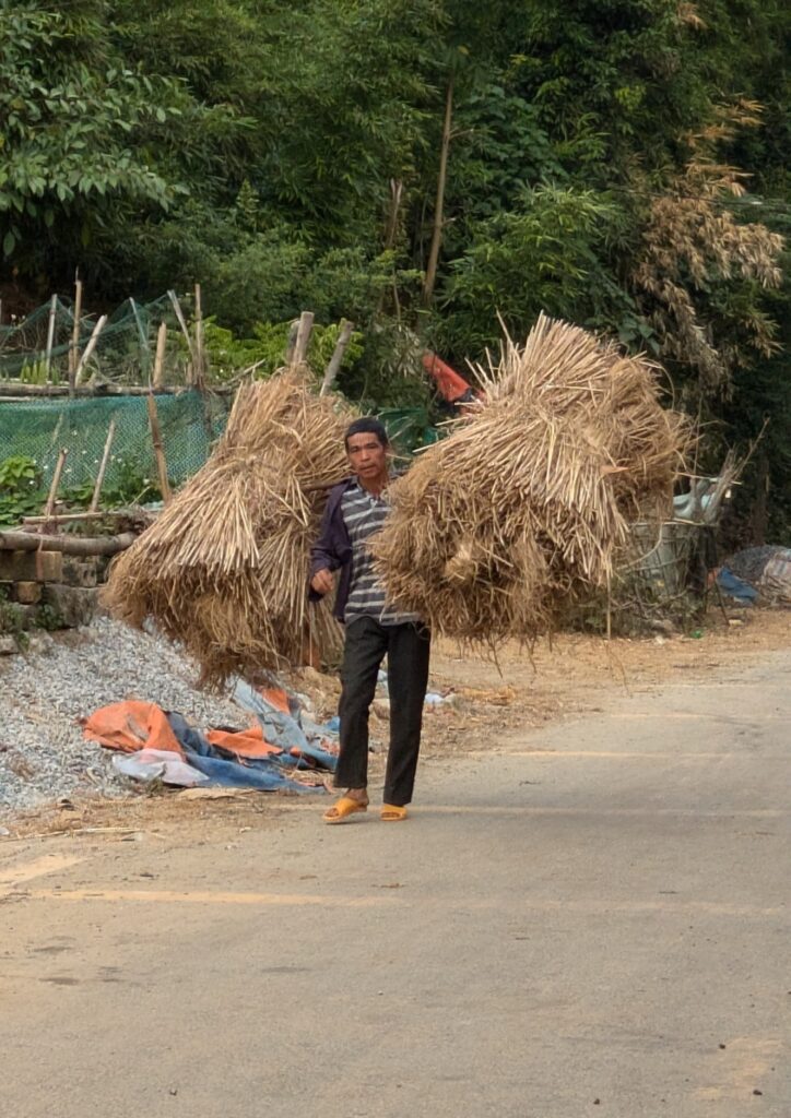
So many locals are still dealing with harvesting. I could not get enough of seeing the bundled rice straw. It was here I also noticed how they stack the bundles around a post and it gets 20 feet tall. It was just so beautiful especially with the backdrop of the karst topography and an everpresent river. Our next stopping was at a bridge over the river another idealist photo setting, but worthy of taking a small rest to stretch and get off the bikes. As we get onto the bridge, there’s a “pen” in the water for ducks. We load back up and push on to our lunch spot.
By 1200, we had stopped at Nha Hang Thu Thanh Restaurant in a small busy town. The only lazy thing was the dog sleeping in the middle of the entry area in the restaurant! Em went back and ordered our lunch. We were served crispy pork belly and tomatoes stewed; pork and pickled white radishes; soup of greens; steamed bok choy and of course rice. Em also got me a black, iced coffee, and Jeff a tea. The coffee was not very much so I had a can of Coke also. We hung around until 1315 just relaxing – I wanted to stretch out and lay down like that dog, LOL.
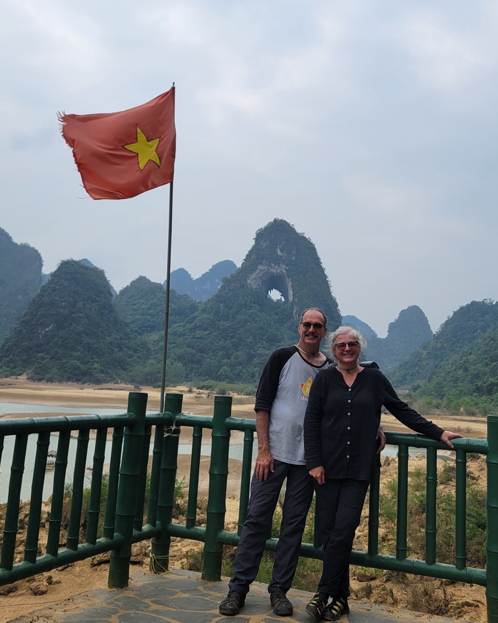
Anyway, back on the road, we went to Angel’s Eye. (The UNESCO placard posted at the site translates from Google as “Famous Landscape of Mountain God’s Eye”. I thought that was interesting.) We parked, but only the three of us went on down on a road into a valley that the peak emerges from. It is a big hole in a peak, and it looks like an eye – fascinating! The Angel’s Eye is natural hole formed in this Karst mountain. A placard said the opening of the hole is 50 m (164 ft) in diameter. It sits way up in the peak, pretty impressive. There was a drying up lake, I guess you would call it, in the mountain’s foreground. Em said in the dry season the water is gone and it becomes a place for rolling grass. But during rainy season it is a series of little lakes . We could see the small boats, one is already dry docked. Anyway, we gave Em my phone and she took too many pictures of us again. She’s hard to resist when she says “photo, photo.” (Plus, I know I can delete the massive duplicates.) We head back to the bikes.
Next, we drove through several linked, very picturesque valleys on a newly constructed road and then a road badly in need of repairs. We stopped for a photo op area of a grassy overlook towering above a terraced valley with the always present Karst Mountains. I don’t think I will get tired of looking at this area in our four days. It was here I taught Em “I Love You” in sign language. We get back on our bikes and move on.
Mr Chinh, my driver, leading at this point, had pulled away from Em with her driver. Well, he took a wrong turn. When he realized they weren’t behind us, he pulled over and did a WhatsApp with Em. We turned around and found them. Gotta love WhatsApp!! Back on track with Em’s driver now leading, we go to a small part of the Ho Chi Minh trail. It’s along a stream, which has the same ethereal greenish color we have been seeing so much in this area. People were putting stones in place, channeling the stream. Em said they are making areas where they can grow vegetables when the water goes down. Huh!? Em next told us this area is where Ho Chi Minh stayed during 1941-1945. It seems to have an almost religious feel – as we are lead past HCM’s fishing hole, another place was his cave where he slept, and then his table outside near the stream that he would sit and reflect at. The placards here relate him as Uncle Ho. He is a founding father of Vietnam. I looked up when he died- it was in 1969. Before Vietnam was fully unified Vietnam.
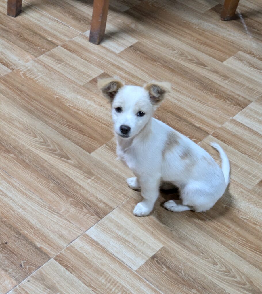
Anyway, from here we went right to our Homestay. As we were going though, we did catch a glimpse of color in the sky from a sunset that we couldn’t see. It has been hazy and very overcast much of the day. When we arrived at Homestay Pac Bo, we were greeted by puppies and dogs! What a welcome!! We were checked in by Em; taken to our room – a VIP one, via a grand staircase up; unloaded our stuff; and cleaned up for supper.
At 1900, we went down. Supper was ready. We had excellent spring rolls – best yet; pork and pickled bamboo shoots; some more homemade, smoked sausage; greens and garlic; soup of pineapple and tomatoes, which worked well together; and rice. Em’s driver had more corn moonshine (He had some our first night also, so it will be a thing.); and we did a couple salutes learning the Vietnamese one- “Mot Hai Ba; Mot Hai Ba; Mot Hai Ba, Do”. It means “One Two Three with the “Do” being cheers. We enjoyed. The puppies and dogs got in and a smokey colored, beautiful cat. Of course they all begged. So we had dinner and a show. HEE-HEE!
I called my mom in the middle of dinner (I needed some break from all the food they keep putting in our bowls! After supper we went back to our room. I sent myself some reminders of today’s activities. Then we linked up with our church brethren back home.
We covered 135 km today – 84 miles. What a glorious, full day!
