Seoul, Korea #3
October 7,
I woke up at 0438 as Jeff was coming back to bed. The alarm was set for 0445, so we went ahead and got around. We have to catch a tour bus at 0555. We are going to the DMZ- Demilitarized Zone. The tour was supposed to meet at 0730, but because of the Korean Holiday time we are going early! So it might be pretty crowded. Anyway, it was still darkish outside as we made our way to catch a city bus that had our stop right on its path. On the bus – there was no traffic out. In fact, the busiest place was where we got off. It was raining and 63 degrees.
We arrived at 0537 and found our tour bus. There were four tour buses lined up and lots of people around. We were the first ones on. Sadie, our guide, met and welcomed us, thanking us for coming early. She’s the organizer that we WhatsApped with last night. The tour bus filled up, and we left right on time at 0600. One person didn’t make it. As we were underway, Sadie explained the background of DMZ… After WWII and the Japanese occupation ended, Koreans could not decide on a government. The North wanted Communism and the South wanted Democracy. A ruler was set up in the north Kim Il Sung. (This is the current dictator, Kim Jong Un’s grandfather.) Anyway in 1950, he invaded South Korea with Chinese and Russian backing, starting the Korean War. UN backed troops came to the aid of South Korea. As the war was in peace negotiations in 1953, Sadie said the South invaded North Korea. This caused a cease fire. So no common end or surrender of war happened – theoretically, they are still at war!! The DMZ was set up by the UN. It’s roughly along the 38th parallel. Sadie said there are 4 “lines” at the border. The first one is the CCL- Civilian Control Line. Then five km north of this is the Southern Limit Line, which is the border of South Korea. After two km more is the Military Demarcation Line, the third line; then two more km is the last line, the Northern Limit Line – border of North Korea. So the DMZ is the 2km on either side of the Military Demarcation Line… a buffer area between North and South Korea. WOWZA!
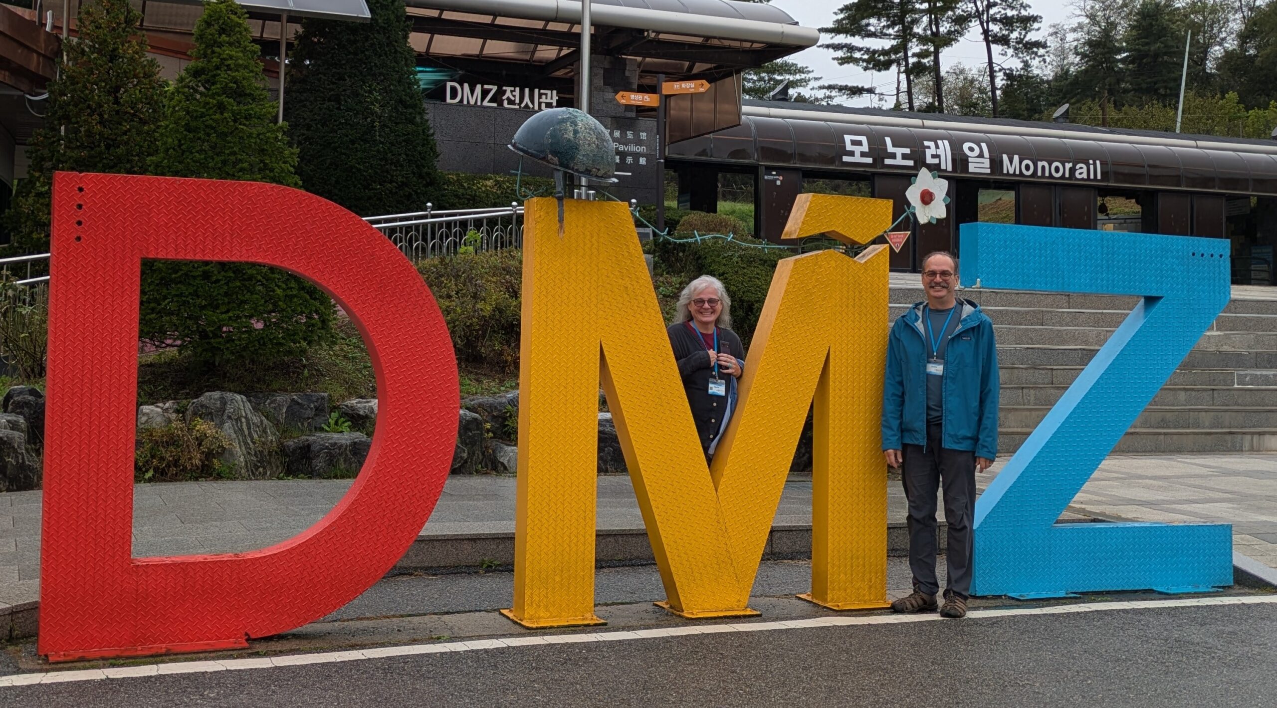
When we arrived at 0636 we came into the parking area of Imjingak Pavilion where the tour begins. Sadie went and procured us tickets – which we did squeeze in, she said. There were already many buses. It is a first come/first serve basis! We unloaded and used the restroom and met back together as Sadie explained some of the stuff around. There were pylons from an old Freedom Bridge with a small part of it – the planks – restored off in an area to walk on. The bridge’s only purpose was for the 12,773 POWs exchange in 1953 and then it was destroyed. Also the Imjingak Railway bridge built recently, but not in use now; and a symbolic Dokgae Bridge of a railroad bridge that was destroyed during the war – it was the closest we could walk out on our own. This whole area is still under military control. Sadie said it can be shut down at any time. Two other items Sadie showed us: an old bombed Steam Locomotive that had been bombed and derailed around this area; and a Peace Bell, symbol in the hopes of reunification.
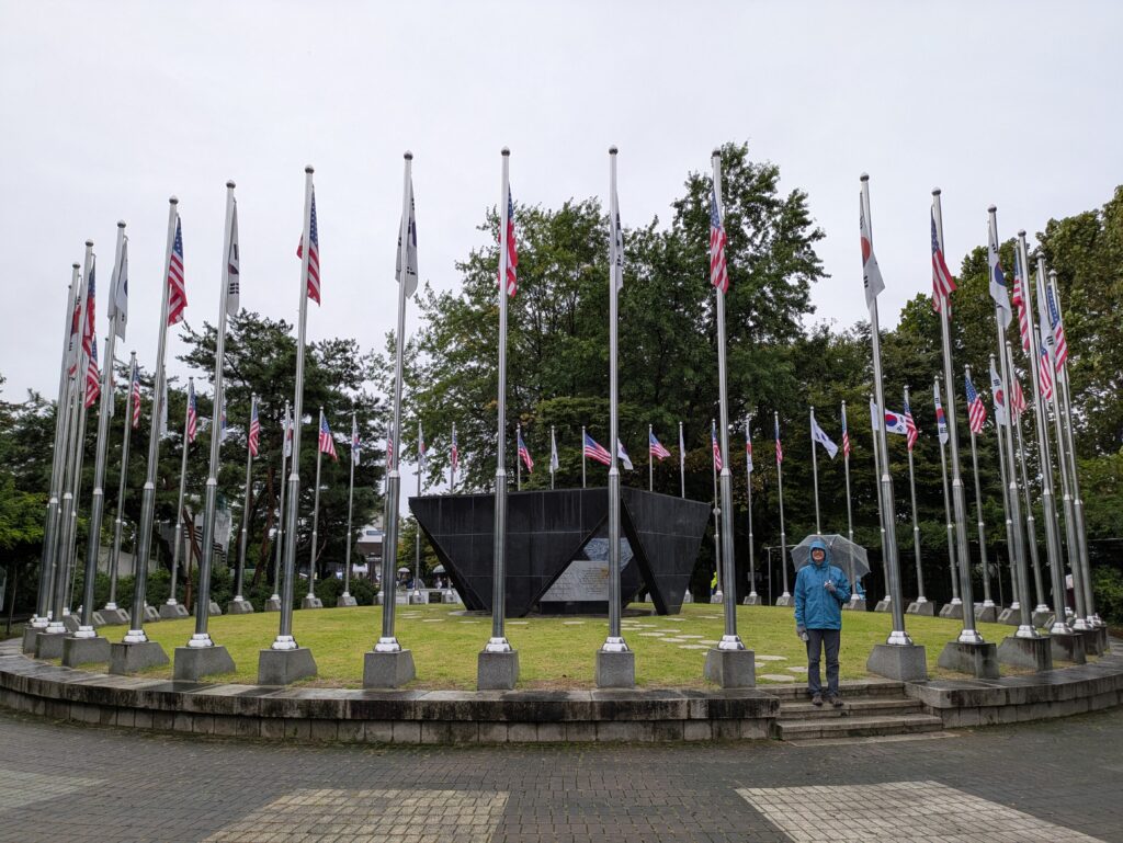
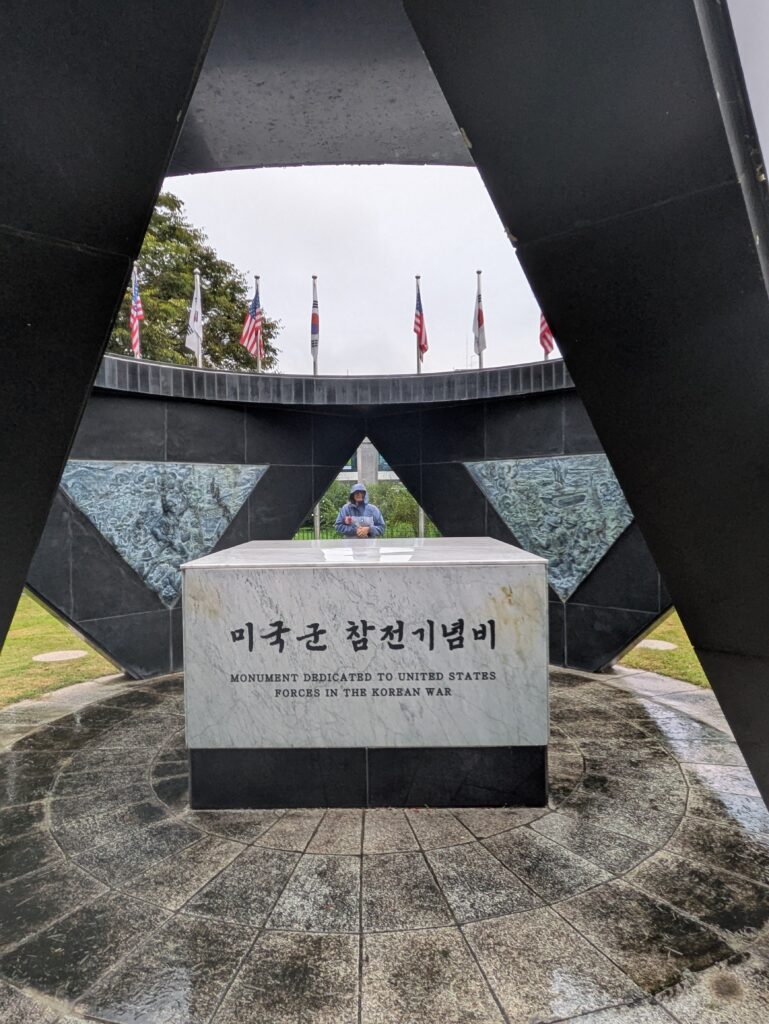
Then we were given time and explored on our own going to the Korean Monument to the US Forces first. We discussed Jeff’s dad being here in Korea in 1957, after the war… it seemed appropriate! We hurriedly went to a meet up with a large number of people who signed up to “interview” with a “Defector.” The group was so big that there was not really talking involved. The Defector – a person who has illegally left North Korea and come here – was a middle aged woman. She was a nurse in North Korea and defected through China via the river at the border on a tire tube, through Laos then Thailand and finally to South Korea. She only spoke Korean and another lady translated her story. The translator then fielded some questions from the group – this was our talk session part. It was fascinating to hear and just see her. The Defector’s primary ‘likes’ of being in South Korea were freedom, and being able to do what you want to do. She misses her family in North Korea – her mother and brother were killed because of her defection – and the fresh air, as there are no working factories there and hence no pollution.
Then we got food at a local place, Eosuijeong Guksu. We got two kinds of dumplings, a kimchi set and a meat set. These fast, local places have a few dishes you either tell the person behind the counter or self-order on a digital machine. They are mostly self service for cutlery, water and side dishes. The dumplings were good and we shared a watermelon tea that wasn’t as good. We paid 17,000 KRW, or $11.97. Next we purchased tickets to go out on a walkway built where the old bridge was (only $2.81). Also included was a bunker turned into some kind of an art exhibit, in there were some videos. It was crowded and other people were controlling the video selection, so we left. We did a few photo ops and meandered.
By 0900, we were all back on the bus. Sadie was getting our tickets and took a bit longer than usual. Originally she said only two minutes, but turned into five. When she came back she had to take our passports for them to see, that was another five. Finally we left for the military controlled bridge. At 0930, the military came on the bus at the checkpoint and CCL. At 0935, we crossed the “cow” bridge. It was funded by the founder of Hyundai, Chung Ju-yung. (He has a fascinating story on Wikipedia.) The cow comes into play when he herded 1,001 cows into North Korea as repayment 1,000 times over for a cow he stole from his father when he left. Anyway, at 0942, we crossed into the DMZ. Sadie pointed out signs for landmines that are still active here. Shortly we arrived at The Third Tunnel. We got off the bus and Sadie explained the tunnel was built by North Koreans to invade the South. It was discovered in 1978 and was the largest: height and width of 2m (6.5 feet) each way and is 1,635 m long (5,364 feet). The first two were found in three previous years. Sadie told us what to look for as we walked down into the tunnel. We had to put on hard hats as the tunnel was rough-cut and low, as the North Koreans had dynamited through the granite. We were able to go just short of the Military Demarcation Line and look into a glass put into a concrete barrier. WOWZA!
At 1045, we exited the tunnel. We took some more photos of us. We all loaded onto the bus by 1055, going to the Dora Observatory. We were able to go to the roof and look across the landscape of the DMZ. Sadie pointed out the N. Korean and S. Korean flags and various other landmarks. But the weather was socking in and visibility began to be limited. And it began raining, not just the ever-existing drizzle we have been experiencing all morning. We bought a muffin and shared a lemon tea in the cafe – it cost us 10,000 KRW, $7.02. At 1150, we all were back on the bus. At 1155, we unloaded into a village, Tongilchon or Unification Village. It is the only village allowed in the DMZ. Only farmers live here and grow rice, soybeans, and ginseng. The only way to live here is to marry a local villager! We explored a bit, just buying some water. Then we loaded back onto the bus and went back out the bridge through the checkpoint and pretty much drove back to Seoul. What an adventure!!!
When we arrived back in Seoul around 1300. We went to a place (don’t know the name of the place) for a late lunch. We had a self-order digital screen. We were trying to do it – a worker came over and helped us. We had Shrimp Wonton Noodles and Jjolmyeon, which is a buckwheat, chewy noodle in a zangy sauce and it’s cold. It was all very good, and cost us 19,500 KRW, or $13.69.
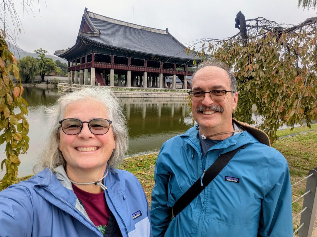
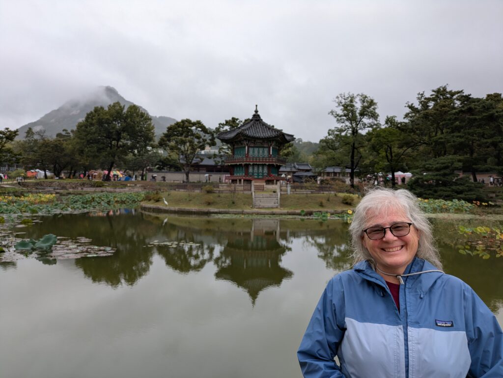
We left, and caught a bus, deciding to go to the Gyeongbokgung Palace. As we were approaching it – there was some kind of a peaceful protest(?) going on at the entrance. We snaked through to the entry – again it was free due to Holiday. There were quite a number of people here as well, many in rented formal costumes. It has more buildings, but all have been restored several times. Originally built in 1395; destroyed during Japanese invasion in 1592-1598; left derelict for 270 years; then reconstructed in 1867; and finally torn down again by another Japanese occupation (WWII) with final restoration started in 1990 to now – according to a placard inside the entrance. The most interesting buildings had water surrounding them. We kind of hurried through as the weather was still drizzly and getting colder.
We left by catching a bus back near our place, stopping at a UNESCO Shrine. I wasn’t impressed with it. I don’t know what I was expecting, but it was just a building. Anyway, we finally walked back to our place and relaxed; then snack supper, sharing ramen and crackers: and bed by 2100!